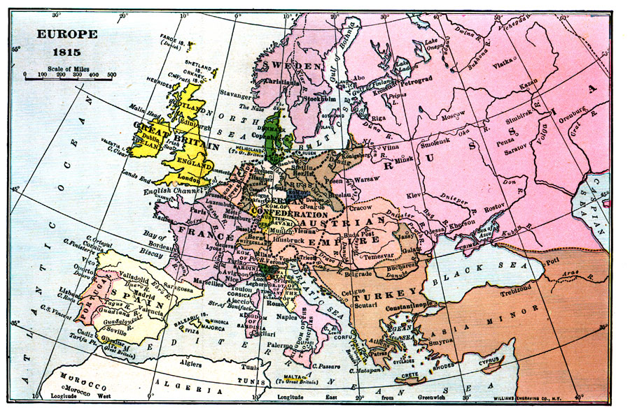
Description: This map depicts Europe in 1815 after the fall of the French Empire and the creation of the German Confederation by the Congress of Vienna.
Place Names: A Complete Map of Europe, Austrian Empire, Kingdome of Sardinia, Kingdom of the Netherlands, German Confederation, Prussia, Kingdom of the Two Sicilies
ISO Topic Categories:
Keywords: Europe, kGermanConfederacy, Unknown,1815
Source: Lucius Hudson Holt, A Brief History of Europe From 1789 to 1815 (New York, NY: The MacMillan Company, 1920) 346
Map Credit: Courtesy the private collection of Roy Winkelman |
|