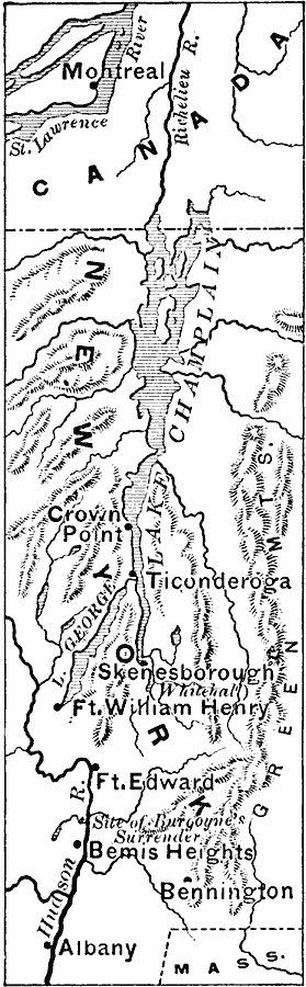
Description: A map of the frontiers of Canada and New York around Lake Champlain showing the Saratoga Campaign of British General John Burgoyne (1777) during the American War of Independence. The map shows Montreal, Canada, Ticonderoga on Lake Champlain, Skenesborough (Whitehall), Fort Edward, and the site of Burgoyne's surrender north of Bemis Heights.
Place Names: A Regional Map of North America, Canada, �United State
ISO Topic Categories: boundaries,
intelligenceMilitary,
inlandWaters,
location
Keywords: Burgoyne's Campaign, physical, �historical, �political, kAmericanRevolution, physical features, country borders,
major political subdivisions, American Revolution, boundaries,
intelligenceMilitary,
inlandWaters,
location, Unknown, 1777
Source: Edward Eggleston, The Household History of the United States and Its People (New York, NY: D. Appleton and Company, 1898) 179
Map Credit: Courtesy the private collection of Roy Winkelman |
|