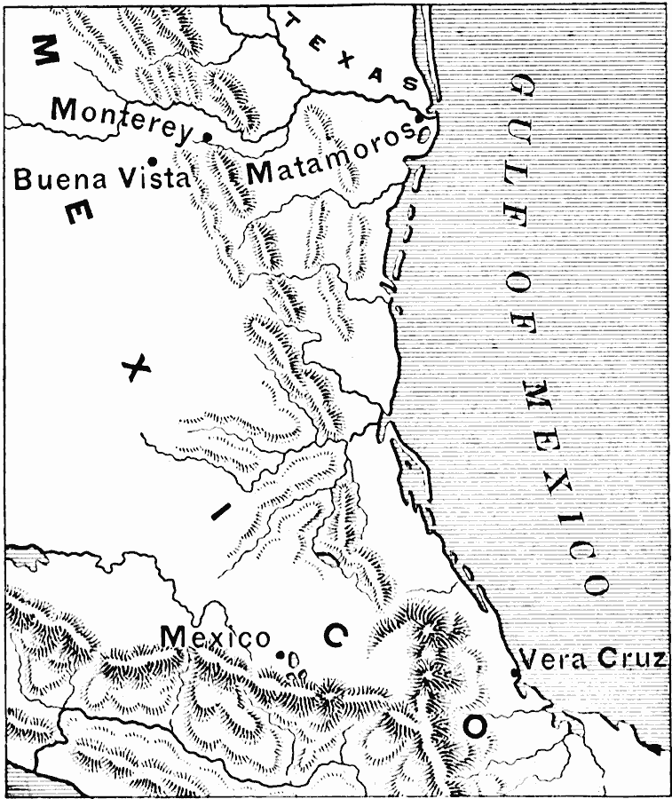
Description: A map of eastern Mexico along the Gulf showing important battle sites during the Mexican–American War (1846–1848), including Matamoros, Monterey, and Buena Vista during the Taylor campaign, and Vera Cruz and Mexico City during the Scott campaign.
Place Names: Mexico, Mexico City, �Monterrey, �Veracru
ISO Topic Categories: boundaries,
inlandWaters,
location,
oceans
Keywords: Northeast Mexico, physical, �political, �historical, �mexican war, physical features, country borders, other military, boundaries,
inlandWaters,
location,
oceans, Unknown, 1846–1848
Source: Edward Eggleston, The Household History of the United States and Its People (New York, NY: D. Appleton and Company, 1898) 290
Map Credit: Courtesy the private collection of Roy Winkelman |
|