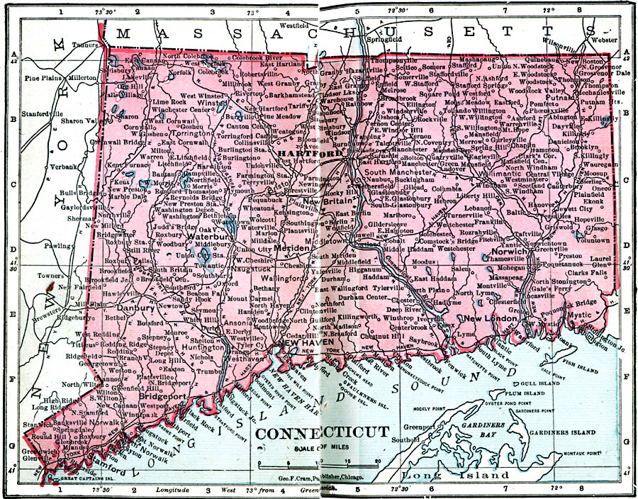
Description: A map from 1906 of Connecticut showing the State capital of Hartford, major cities and towns, railroads, lakes and rivers, and the coastal features of the Long Island Sound.
Place Names: Connecticut, Bridgeport, �Derby, �Hartford, �Meriden, �Middletown, �New Britain, �New Haven, �New London, �Norwich, �Waterbur
ISO Topic Categories: boundaries,
inlandWaters,
location,
oceans
Keywords: Connecticut, physical, �political, �borders, �boundaries, �physical features, country borders, boundaries,
inlandWaters,
location,
oceans, Unknown, 1906
Source: George F. Cram , Cram's Quick Reference Atlas and Gazetteer of the World (Chicago , IL: George F. Cram Series of Atlases, 1906) 15
Map Credit: Courtesy the private collection of Roy Winkelman |
|