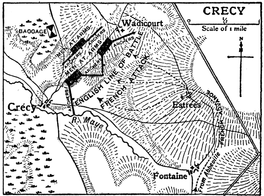
Description: This is a map of Crecy, France depicting the Battle of Crecy during the Hundred Years' War. It shows surrounding towns, the English line of attack, the French attack and inland waters. "Crecy, a town of northern France, in the department of Somme, on the Maye, 12 m. N. by E. of Abbeville by road. It is famous in history for the great victory gained here on the 26th of August 1346 by the English under Edward III over the French of King Philip of Valois." — The Encyclopedia Britannica, 1910
Place Names: France, Crecy, �Somme, �Maye River, �Fontaine, �Estrees, �Wadicour
ISO Topic Categories: boundaries,
society,
inlandWaters
Keywords: Crecy, physical, �political, �historical, �Hundred Years' War, �French, �English, kBattle, kHundredYearsWar, physical features, major political subdivisions, other military, boundaries,
society,
inlandWaters, Unknown,August 26, 1346
Source: The Encyclopedia Britannica, The Encyclopedia Britannica 11th Edition Vol. 7 (New York, NY: The Encyclopedia Britannica Company, 1910) 389
Map Credit: Courtesy the private collection of Roy Winkelman |
|