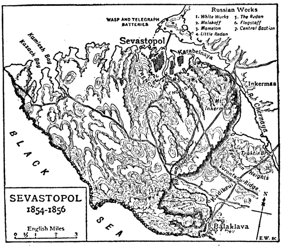
Description: This is a map depicting the siege of Sevastopol during the Crimean War. This map shows the Russian Defence Works by number, and the English and French positions. This siege lasted for eleven months and led to Russian defeat in the Crimean War.
Place Names: Ukraine, Crimea, �Crimean Peninsula, �Sevastopol, �Karabelnaya, �Balaklava, �Vorontsov Ridge, �Kadikeui, �Kamlesh Bay, �Karach Bay, �Inkerman, �Fedukhin Heights, �Chernaya River, �Traktir Br., �Black Se
ISO Topic Categories: boundaries,
inlandWaters,
oceans,
society
Keywords: Sevastopol, physical, �political, �historical, �Crimean War, physical features, major political subdivisions, other military, boundaries,
inlandWaters,
oceans,
society, Unknown,1854–1856
Source: The Encyclopedia Britannica, The Encyclopedia Britannica 11th Edition Vol. 7 (New York, NY: The Encyclopedia Britannica Company, 1910) 451
Map Credit: Courtesy the private collection of Roy Winkelman |
|