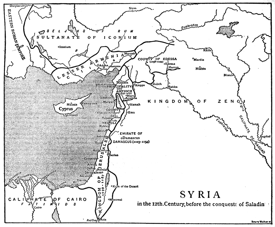
Description: A map of the Syrian region prior to the retaking of Jerusalem by Saladin, Sultan of Egypt in 1187. The map shows the Seljuk territories and the Crusader States established during the first and second crusades, with their dates of conquest. This map shows the boundaries of the Eastern Roman Empire, Sultanate of Iconium (Seljuks of Rum), Kingdom of Zengi, Caliphate of Bagdad, Caliphate of Cairo, Lesser Armenia (Cilicia), Cyprus, County of Edessa, Principality of Antioch, Assassins (Nizari Ismailis), County of Tripoli, and the Kingdom of Jerusalem. The map shows historically significant cities and rivers of the period.
Place Names: Southwest Asia, Syria, �Lebanon, �Jerusalem, �Palestine, �Israel, �Kingdom of Zengi, �Iraq, �Bagdad, �Euphrates River, �Damascus, �Cyprus, �Saudi Arabia, �Sinai Desert, �Jordan, �Edessa, �Turkey, �Anatolia, �Hamah, �Ems, �Egypt, �Cairo, �Red Sea, �Atla, �Tigris River,
ISO Topic Categories: boundaries,
inlandWaters,
oceans,
society
Keywords: Syria Before the Conquests of Saladin, physical, �political, �historical, �Crusades, physical features, major political subdivisions,
country borders, other military, boundaries,
inlandWaters,
oceans,
society, Unknown,1098–1187
Source: The Encyclopedia Britannica, The Encyclopedia Britannica 11th Edition Vol. 7 (New York, NY: The Encyclopedia Britannica Company, 1910) 548
Map Credit: Courtesy the private collection of Roy Winkelman |
|