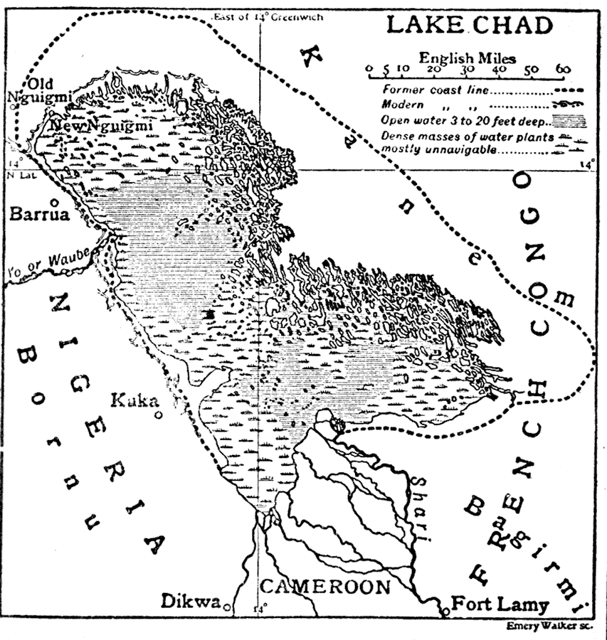
Description: This is a map of Lake Chad showing its present coastline (circa 1910) and its coastline previous to 1910. It reveals how Lake Chad is continuously shrinking. "Chad, a lake of northern Central Africa, is situated about 850 ft. above the sea in the borderland between the fertile and wooded regions of the Sudan on the south and the arid steppes which merge into the Sahara on the north. The area of the lake is shrinking owing to the progressive desiccation of the country, Saharan climate and conditions replacing those of the Sudan. The drying up process has been comparatively rapid since the middle of the 19th century, a town which in 1850 was on the southern margin of the lake being in 1905 over 20 m. from it." — The Encyclopedia Britannica, 1910
Place Names: A Regional Map of Africa, Nigeria, �Chad, �Niger, �Cameroon, �Lake Chad, �Fort Lamy, �Dikwa, �Kuka, �Barrua, �Old Nguimi, �New Nguimi, �Shari River, �Chari River, �French Congo, �Kan
ISO Topic Categories: boundaries,
inlandWaters
Keywords: Lake Chad, physical, �political, �hydrological, physical features, country borders, water depths, boundaries,
inlandWaters, Unknown,1910
Source: The Encyclopedia Britannica , The Encyclopedia Britannica 11th Edition Vol. 5 (New York, NY: The Encyclopedia Britannica Company, 1910) 787
Map Credit: Courtesy the private collection of Roy Winkelman |
|