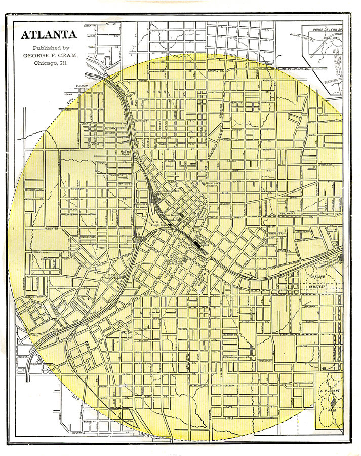
Description: A city plan from 1886 detailing Atlanta, showing the city limits, streets and street names, Union train depot and the rail routes, the old and new State Capitol buildings and Governor's mansion, two large cotton manufacturing plants, the Oakland Cemetery, and L. P. Grant Park.
Place Names: Georgia, Atlanta
ISO Topic Categories: boundaries,
transportation
Keywords: Atlanta, political, �transportation, �L. P. Grant Park, �Oakland Cemetery, local jurisdictions, roads,
railroads, boundaries,
transportation, Unknown,1886
Source: George F. Cram, (Chicago, IL: Geo. F. Cram, 1886) 173
Map Credit: Courtesy the private collection of Roy Winkelman |
|