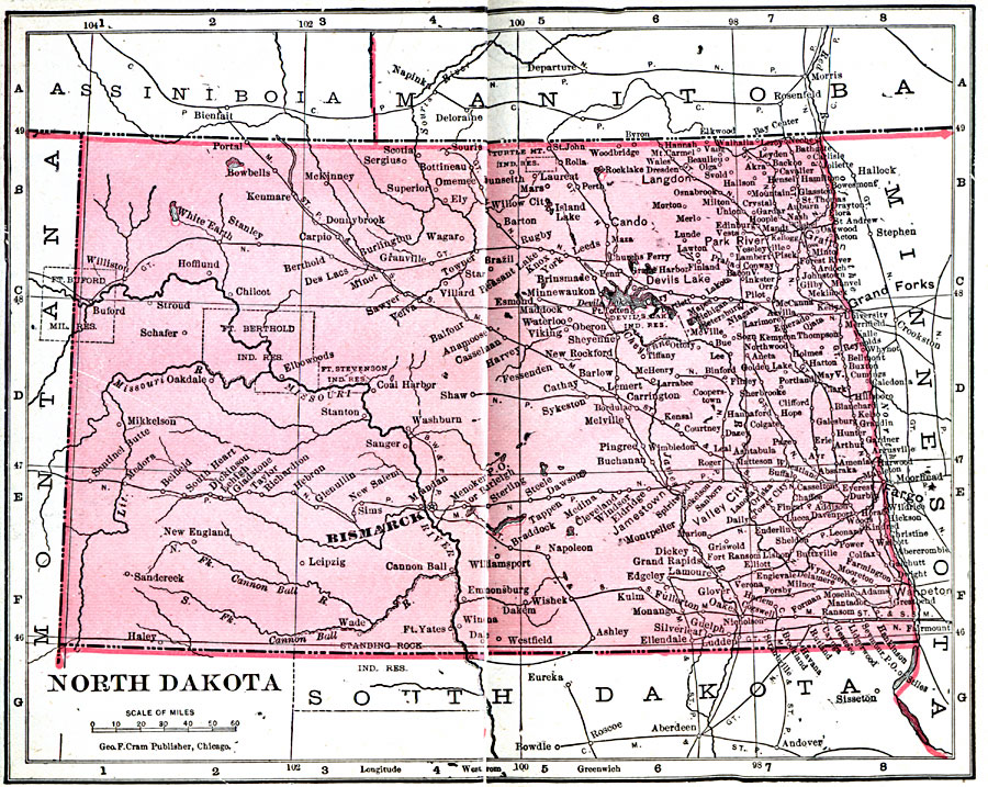
Description: A map from 1906 of North Dakota, showing the capital of Bismarck, principal cities and towns, Indian reservations, railroads, mountains, lakes, and rivers.
Place Names: North Dakota, Bismark, �Casselton, �Fargo, �Ft. Buford, �Grafton, �Grand Forks, �Jamestown, �Pembina, �Valley City, �Wahpeto
ISO Topic Categories: boundaries,
inlandWaters,
location,
oceans
Keywords: North Dakota, physical, �political, �borders, �boundaries, kNativeAmerican, physical features, country borders, boundaries,
inlandWaters,
location,
oceans, Unknown, 1906
Source: George F. Cram , Cram's Quick Reference Atlas and Gazetteer of the World (Chicago , IL: George F. Cram Series of Atlases, 1906) 42
Map Credit: Courtesy the private collection of Roy Winkelman |
|