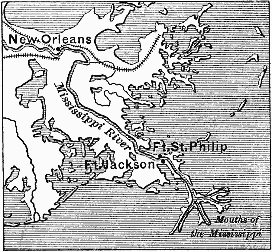
Description: A map of New Orleans and the Mississippi Delta at the time of the American Civil War, showing the railroads in the area, and the strategic Confederate forts St. Philip and Jackson. These forts were a first line of defense for the city during the American Civil War, and in April, 1862, fell to the Union.
Place Names: Louisiana, New Orlean
ISO Topic Categories: inlandWaters,
location,
oceans,
intelligenceMilitary
Keywords: New Orleans, physical, �transportation, �political, �historical, physical features, railroads, Civil War, inlandWaters,
location,
oceans,
intelligenceMilitary, Unknown, 1862
Source: Edward Eggleston, The Household History of the United States and Its People (New York, NY: D. Appleton and Company, 1898)
Map Credit: Courtesy the private collection of Roy Winkelman |
|