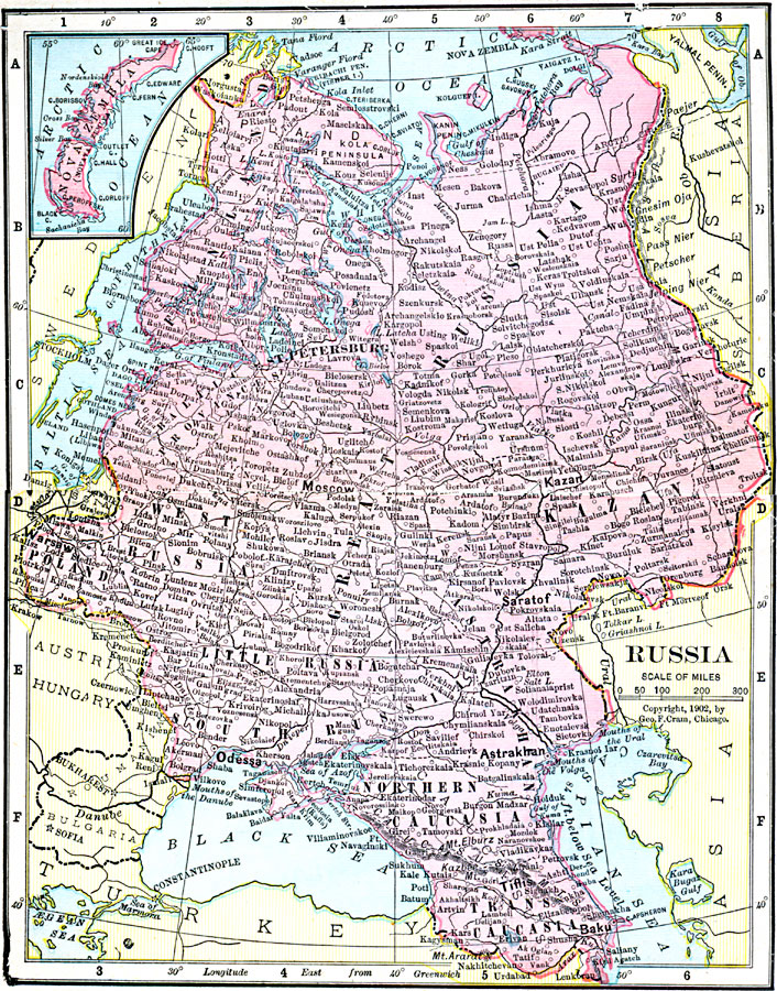
Description: A map of European Russia in 1906 from Poland to the Ural Mountains and the Arctic Ocean to Trans Caucasia between the Black and Caspian seas. The map shows major cities, railways, provinces, rivers, and mountain systems, and an inset map of the northern island Nova Zembla.
Place Names: Eastern Europe, Moscow, �Russia, �St. Petersburg, �Polan
ISO Topic Categories: boundaries,
inlandWaters,
location,
oceans
Keywords: Russia, physical, �political, �borders, �boundaries, �physical features, country borders, boundaries,
inlandWaters,
location,
oceans, Unknown, 1906
Source: George F. Cram , Cram's Quick Reference Atlas and Gazetteer of the World (Chicago , IL: George F. Cram Series of Atlases, 1906) 84
Map Credit: Courtesy the private collection of Roy Winkelman |
|