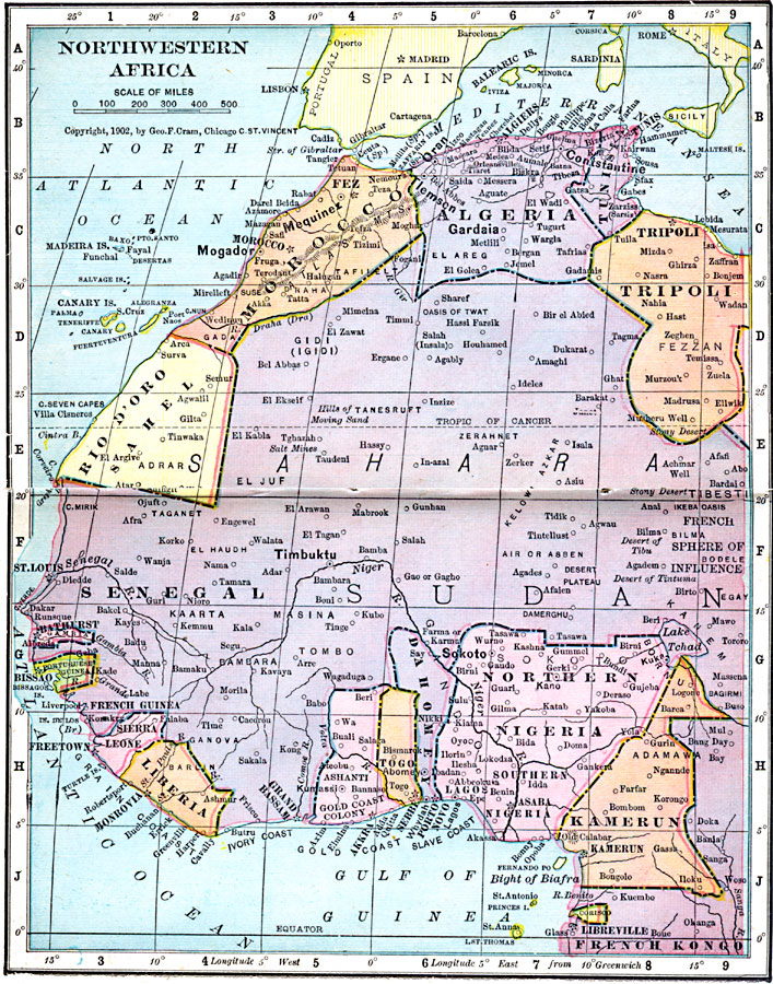
Description: Map of Northwestern Africa in 1906 showing the Barbary States of Morocco, Algeria, Tunis, and a portion of Tripoli, the western country of Rio de Oro, and the Upper Guinea States of Gambia, Portuguese Guinea, Sierra Leon, Liberia, Ashanti–Gold Coast Colony, Togo, Dahomey, Northern and Southern Nigeria, Kamerun, and Corisco or Spanish Guinea. The map also shows the French territories of Senegal, French Guinea, Grand Bassam, and French Kongo. The map shows major cities, ports, and trade centers, railroads, rivers, and mountain systems.
Place Names: A Regional Map of Africa, Algeria, �Fez, �Kamerun, �Liberia, �Morrocco, �Nigeria, �Senegal, �Timbukt
ISO Topic Categories: boundaries,
inlandWaters,
location,
oceans
Keywords: Northwestern Africa, physical, �political, �borders, �boundaries, �physical features, country borders, boundaries,
inlandWaters,
location,
oceans, Unknown, 1906
Source: George F. Cram , Cram's Quick Reference Atlas and Gazetteer of the World (Chicago , Illinois : George F. Cram Series of Atlases, 1906) 90
Map Credit: Courtesy the private collection of Roy Winkelman |
|