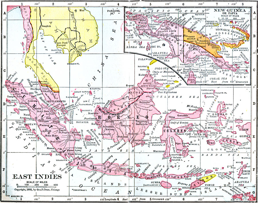
Description: A map from 1906 of the East Indies, including the Malay Peninsula, Borneo, Sumatra, Java, Celebes, and smaller islands, with an inset map of New Guinea or Papua. This map shows the political boundaries of the time, including the British possessions and protectorates of the Straits Settlements (along the Straits of Malacca), Federated Malay States, Sarawak, British North Borneo and New Guinea, the islands of the Dutch East Indies, the divided island of Timor with West Timor (Dutch) and East Timor (Portuguese), and the German possessions on New Guinea and the Bismarck Archipelago. The map shows capitals and major cities, ports, prominent mountains and volcanoes, rivers, coastal features, islets, straits, and seas of the region.
Place Names: Southeastern Asia, Borneo, �Celebes,�Ceram, �Java, �New Guinea, �Papua, �Sumatra, �Timo
ISO Topic Categories: boundaries,
inlandWaters,
location,
oceans
Keywords: East Indies, physical, �political, �borders, �boundaries, �physical features, country borders, boundaries,
inlandWaters,
location,
oceans, Unknown, 1906
Source: George F. Cram , Cram's Quick Reference Atlas and Gazetteer of the World (Chicago , IL: George F. Cram Series of Atlases, 1906) 98
Map Credit: Courtesy the private collection of Roy Winkelman |
|