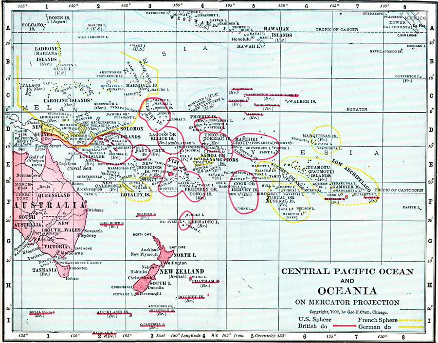
Description: A map of the central Pacific Ocean and Oceania on a Mercator's Projection in 1906. The map shows the territorial possessions of Britain, France, Germany, and the United States in the region.
Place Names: Regional Pacific Ocean, Australia, �Caroline Islands, �Federated States of Micronesia, �Fiji Islands, �French Polynesia, �Hawaiin Islands, �Indonesia, �Kiribati, �Ladrone Islands, �Marshal Islands, �New Zealand, �Papua New Guinea, �Solomon Island
ISO Topic Categories: physical, �political, �borders, �boundaries, kWorldPacific
Keywords: Central Pacific Ocean and Oceania on Mercator Projection, physical, �political, �borders, �boundaries, �physical features, country borders, physical, �political, �borders, �boundaries, kWorldPacific, Mercator,
Unknown, 1906
Source: George F. Cram , Cram's Quick Reference Atlas and Gazetteer of the World (Chicago , IL: George F. Cram Series of Atlases, 1906) 101
Map Credit: Courtesy the private collection of Roy Winkelman |
|