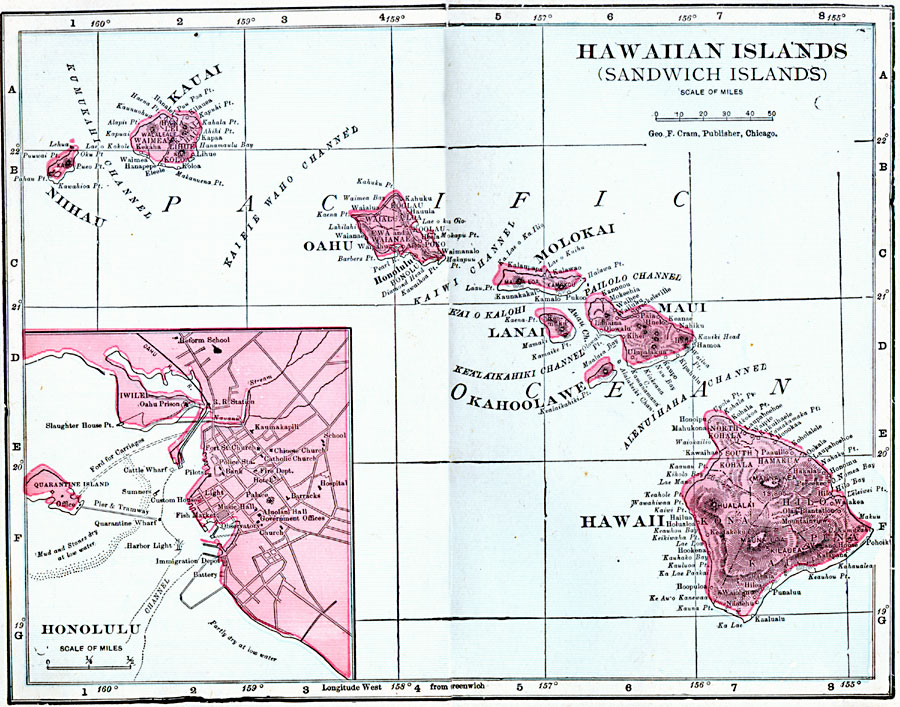
Description: A map from 1906 of the Hawaiian Islands or Sandwich Islands, showing the main islands, towns, ports, volcanoes, terrain, and coastal features. An inset map details the capital Honolulu.
Place Names: Hawaii, Hawaii, �Hawaiian Islands, �Kauai, �Lanai, �Maui, �Molokai, �Nihau, �Oahu, �Waimea, �Pearl City, �Honolulu, �Hil
ISO Topic Categories: boundaries,
inlandWaters,
location,
oceans
Keywords: Hawaiian Islands (Sandwich Islands), physical, �political, �borders, �boundaries, �physical features, country borders, boundaries,
inlandWaters,
location,
oceans, Unknown, 1906
Source: George F. Cram , Cram's Quick Reference Atlas and Gazetteer of the World (Chicago , IL: George F. Cram Series of Atlases, 1906) 102
Map Credit: Courtesy the private collection of Roy Winkelman |
|