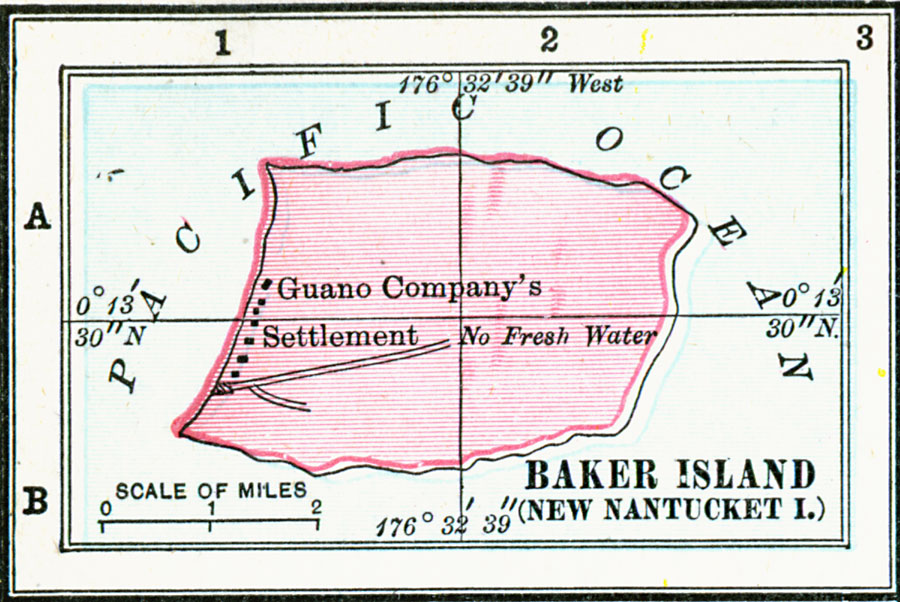
Description: A 1906 map of Baker Island (New Nantucket Island) in the Central Pacific. This atoll was claimed by the United States under the Guano Islands Act of 1856, and this map shows the Guano Company's settlement. The map gives the island's latitude and longitude coordinates, and indicates there is no fresh water available.
Place Names: Regional Pacific Ocean, Baker Island, �New Nantucket Islan
ISO Topic Categories: physical, �political, �borders, �boundaries, kWorldPacific
Keywords: Baker Island (New Nantucket Island), physical, �political, �borders, �boundaries, �physical features, country borders, physical, �political, �borders, �boundaries, kWorldPacific, Unknown, 1906
Source: George F. Cram , Cram's Quick Reference Atlas and Gazetteer of the World (Chicago , IL: George F. Cram Series of Atlases, 1906) 104
Map Credit: Courtesy the private collection of Roy Winkelman |
|