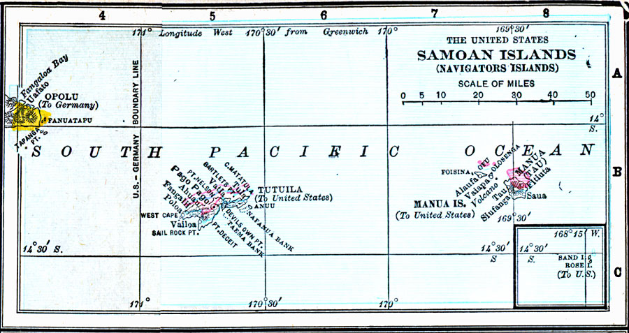
Description: A map from 1906 showing the United States possession of the Samoan Islands (Navigators Islands). The map includes the islands of Manua (Tau), Ofu, Tutuila, Sand Island, and Rose Island, and the German possession of Opolu. The map shows the Samoan capital of Pago Pago, towns, ports, and coastal features, and the boundary between U.S. and German territories along longitude 171° West of Greenwich established at the Tripartite Convention of 1899.
Place Names: Regional Pacific Ocean, Navigators Islands, �Samoan Island
ISO Topic Categories: physical, �political, �borders, �boundaries, kWorldPacific
Keywords: Samoan Islands (Navigators Islands), physical, �political, �borders, �boundaries, �physical features, country borders, physical, �political, �borders, �boundaries, kWorldPacific, Unknown, 1906
Source: George F. Cram , Cram's Quick Reference Atlas and Gazetteer of the World (Chicago , IL: George F. Cram Series of Atlases, 1906) 104
Map Credit: Courtesy the private collection of Roy Winkelman |
|