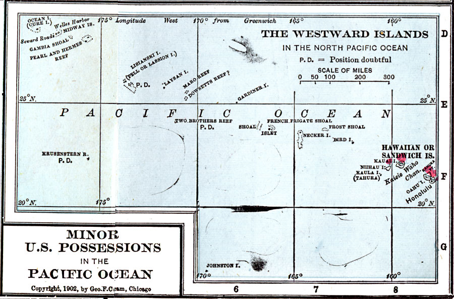
Description: A map from 1906 of the Westward Islands and United States possessions near Hawaii. The map coverage is approximately between latitudes 30° N and 15° N, and longitudes 180° W and 155° W of Greenwich. The map shows the main Sandwich (Hawaiian) Islands of Oahu and Kauai to Midway Island, and the small islands, reefs, and shoals in between. The map notes that the position of some of the smaller features is uncertain.
Place Names: Regional Pacific Ocean, Westward Island
ISO Topic Categories: physical, �political, �borders, �boundaries, kWorldPacific
Keywords: The Westward Islands in the North Pacific Ocean, physical, �political, �borders, �boundaries, �physical features, country borders, physical, �political, �borders, �boundaries, kWorldPacific, Unknown, 1906
Source: George F. Cram , Cram's Quick Reference Atlas and Gazetteer of the World (Chicago , IL: George F. Cram Series of Atlases, 1906) 104
Map Credit: Courtesy the private collection of Roy Winkelman |
|