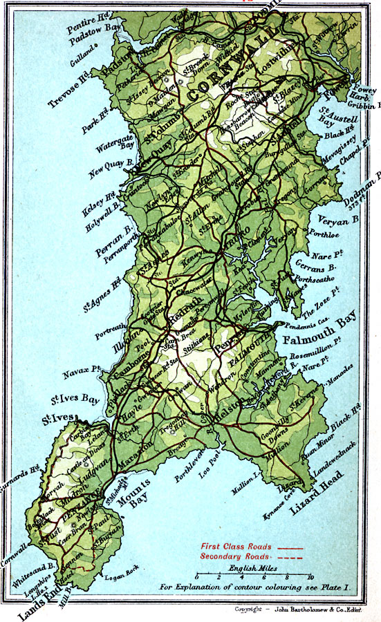
Description: A detailed travel map of the southwestern tip of England from 1908, showing portions of Cornwall County. The map shows first class and secondary roads, railways, cities, towns, ports, rivers, terrain and coastal features of the area. This map uses contour–coloring to show terrain, with elevations shown in feet. Cities on this map include Fowey, Padstow, Falmouth, St. Ives, and Penzance. Coastal features include Trevose Head, Kelsey Head, Lands End, Mounts Bay, Lizard Head, Falmouth Bay, and St. Austell Bay.
Place Names: United Kingdom, Cornwall, �Falmouth Bay, �Lands End, �Lizard Head, �New Quay, �St. Austell, �St. Ives,
ISO Topic Categories: inlandWaters,
location,
oceans,
transportation
Keywords: Cornwall, roads, �transportation, roads, inlandWaters,
location,
oceans,
transportation, Unknown, 1908
Source: J.G. Bartholomew, F.R.G.S., The Handy Touring Atlas of the British Isles Specially Prepared for Cyclists, Motorists, and Travellers (London, United Kingdom : George Newnes, Limited, 1908) 10
Map Credit: Courtesy the private collection of Roy Winkelman |
|