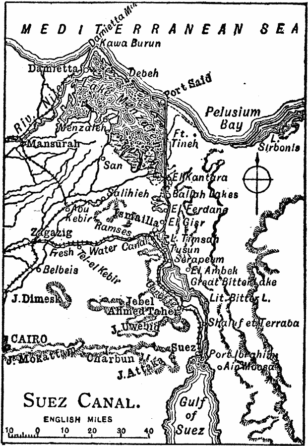
Description: A map of the Suez Canal in 1909 from Port Said on the Mediterranean in the north to Port Ibrahim on the Gulf of Suez in the south. The map shows the railroad connecting the city of Suez to Cairo and the rest of the Nile Delta, freshwater canals, marshes, cities and towns, and the surrounding area.
Place Names: Egypt, Egypt, �Gulf of Suez, �Damretta, �Cairo, �Mansurah, �Zagazig, �Suez, Port Said, Port Ibrahim, Ismailia
ISO Topic Categories: inlandWaters,
location,
oceans,
transportation
Keywords: Suez Canal, physical, �political, �transportation, �suez canal 1909, kSuezCanal, physical features, water routes, inlandWaters,
location,
oceans,
transportation, Unknown, 1909
Source: Chandler B. Beach, The New Student's Reference Work (Chicago, Illinois: F. E. Compton and Company, 1909) 1844
Map Credit: Courtesy the private collection of Roy Winkelman |
|