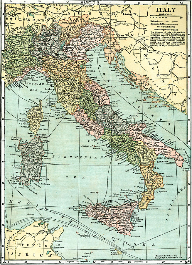
Description: A map of Italy in 1920 showing important cities, railways, and submarine cables, and the territories of Trento, Trieste, Istria, and coastal Dalmatia claimed by Italy under the London Pact (1915). "The Kingdom of Italy is divided into Provinces, of which boundaries are shown and capitals of same are designated...[the] name of Province is in all cases the same as capital towns. The larger divisions, known as Compartimenti, are not now recognized as legal divisions. The newly annexed territory is as yet unorganized."
Place Names: Italy, Palermo, �Catania, �Naples, �Rome, �Salerno, �Chleti, �Perugia, �Ancona, �Florence, �Ravenna, �Bologna, �Modena, �Pisa, �Genoa, �Turin, �Milan, �Venice, �Triest
ISO Topic Categories: boundaries,
inlandWaters,
location,
oceans,
transportation,
utilitiesCommunication
Keywords: Italy, physical, �political, �transportation, �kingdom of italy, �provinces, compartmenti, physical features, country borders,
major political subdivisions, railroads, boundaries,
inlandWaters,
location,
oceans,
transportation,
utilitiesCommunication, Unknown, 1920
Source: , Leslie's New World Atlas (New York City, New York: Leslie-Judge Company, 1920) 20
Map Credit: Courtesy the private collection of Roy Winkelman |
|