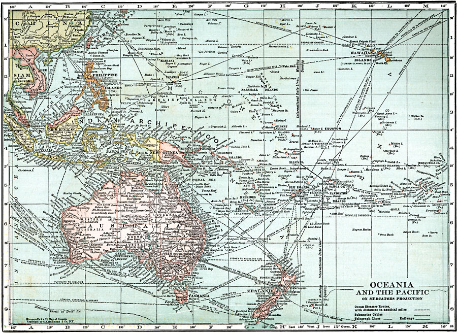
Description: A map from 1920 of Oceania and the Pacific on a Mercator's Projection between latitudes 30° N and 50° S, and longitudes 100° E and 140° W of Greenwich. This map shows cities and ports, ocean steamer routes with distances between major ports given in nautical miles, submarine cable routes, telegraph routes, railways, rivers, lakes, coral reefs, and coastal features of the region. This map also shows the foreign possessions of Britain, France, and the United States at the time. The International Date Line and the extreme northern limit of drift ice are shown.
Place Names: Regional Pacific Ocean, Australia, �Tasmania, �New Zealand, �Wellington, �Fiji Islands, �New Guinea, �Solomon Islands, �Celebes, �Batavia, �Sumatra, �Borneo, �Singapore, �Philippine Islands, �Anam, �Siam, �Hawaiian Islands, �Marshal Islands, �Indonesi
ISO Topic Categories: physical, �political, �transportation, kWorldPacific
Keywords: Oceania and the Pacific, physical, �political, �transportation, physical features, country borders,
major political subdivisions, railroads,
water routes, physical, �political, �transportation, kWorldPacific, Mercator, 1920
Source: , Leslie's New World Atlas (New York City, NY: Leslie-Judge Company, 1920) 29
Map Credit: Courtesy the private collection of Roy Winkelman |
|