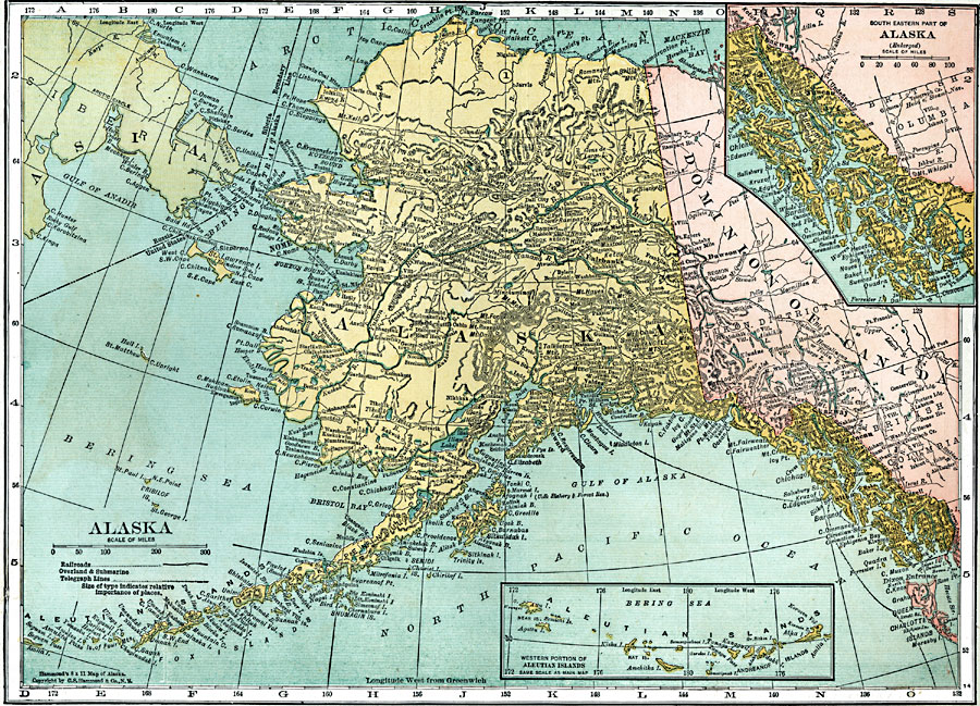
Description: A map of Alaska from 1920 showing the State capital at Juneau, cities, towns, ports, railroads, overland and submarine telegraph lines, major rivers and mountains, coastal features, and islands. The map has inset maps detailing the areas of the southeastern part of Alaska near Sitka, and the western part of the Aleutian Islands.
Place Names: Alaska, Nome, �St. Michael, �Utica Mines, �Muletukeruk, �Tin City, �Shaklolik, �Nikhkak, �Seward, �Valdez, �Fairbanks, �Franklin, �Skagway, �Juneau, �Wrangell, �Sitk
ISO Topic Categories: boundaries,
inlandWaters,
location,
oceans,
transportation,
utilitiesCommunication
Keywords: Alaska, physical, �political, �transportation, physical features, country borders, railroads, temperature, boundaries,
inlandWaters,
location,
oceans,
transportation,
utilitiesCommunication, Unknown, 1920
Source: , Leslie's New World Atlas (New York City, NY: Leslie-Judge Company, 1920) 38
Map Credit: Courtesy the private collection of Roy Winkelman |
|