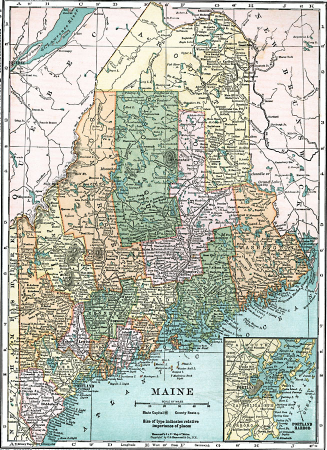
Description: A map from 1920 of Maine showing the State capital of Augusta, counties and county seats, major cities, towns and ports, railroads, mountains, lakes, rivers, and coastal features. An inset map details the vicinity of Portland.
Place Names: Maine, Augusta, �Lewiston, �Auburn, �Portland, �Biddeford, �Waterville, �Eastport, �Houlton, �Bangor, �Brewer, �Oldtown, �Westbroo
ISO Topic Categories: boundaries,
inlandWaters,
location,
oceans,
transportation
Keywords: Maine, physical, �political, physical features, country borders,
major political subdivisions, boundaries,
inlandWaters,
location,
oceans,
transportation, Unknown, 1920
Source: , Leslie's New World Atlas (New York City, NY: Leslie-Judge Company, 1920) 40
Map Credit: Courtesy the private collection of Roy Winkelman |
|