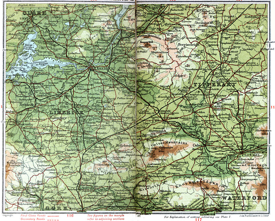
Description: A detailed travel map of Ireland in 1908, showing all or portions of counties Clare, Limerick, Tipperary, and Waterford. The map shows first class and secondary roads, railways, cities, towns, ports, rivers, lakes, and terrain features of the area. This map uses contour–coloring to show terrain, with elevations shown in feet. Cities on this map include Ennis, Killaloe, Nenagh, Templemore, Thules, Limerick, Newcastle, Tipperary, Caher, Clonmel, Lismore, and Mallow. Mountains and rivers include Glennagallagh, Arra, Keeper Hill, Devilsbit, Galtee Mountains, Knockmealdown Mountains, River Shannon, and River Fergus.
Place Names: Ireland, Borrisoleigh, �Caher, �Clare, �Clonmel, �Cork, �Limerick, �Nenagh, �Tipperary, �Waterfor
ISO Topic Categories: inlandWaters,
location,
oceans,
transportation
Keywords: Limerick and Tipperary, roads, �transportation, roads, inlandWaters,
location,
oceans,
transportation, Unknown, 1908
Source: J.G. Bartholomew, F.R.G.S., The Handy Touring Atlas of the British Isles Specially Prepared for Cyclists, Motorists, and Travellers (London, United Kingdom : George Newnes, Limited, 1908) 112-113
Map Credit: Courtesy the private collection of Roy Winkelman |
|