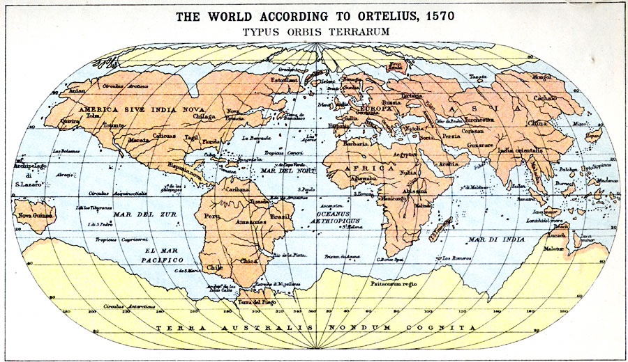
Description: Map shows the world according to Ortelius in the year 1570.
Place Names: A Complete Map of Globes and Multi-continent, globe, �Ortelius, �worl
ISO Topic Categories: inlandWaters,
location,
oceans,
transportation
Keywords: The World According to Ortelius, physical, �physical features, �transportation, physical features, railroads, inlandWaters,
location,
oceans,
transportation, Unknown, 1570
Source: J.G. Bartholomew, LLD, A Literary & Historical Atlas of Europe (New York, New York: E.P. Dutton & Co., Ltd. , 1910) 1
Map Credit: Courtesy the private collection of Roy Winkelman |
|