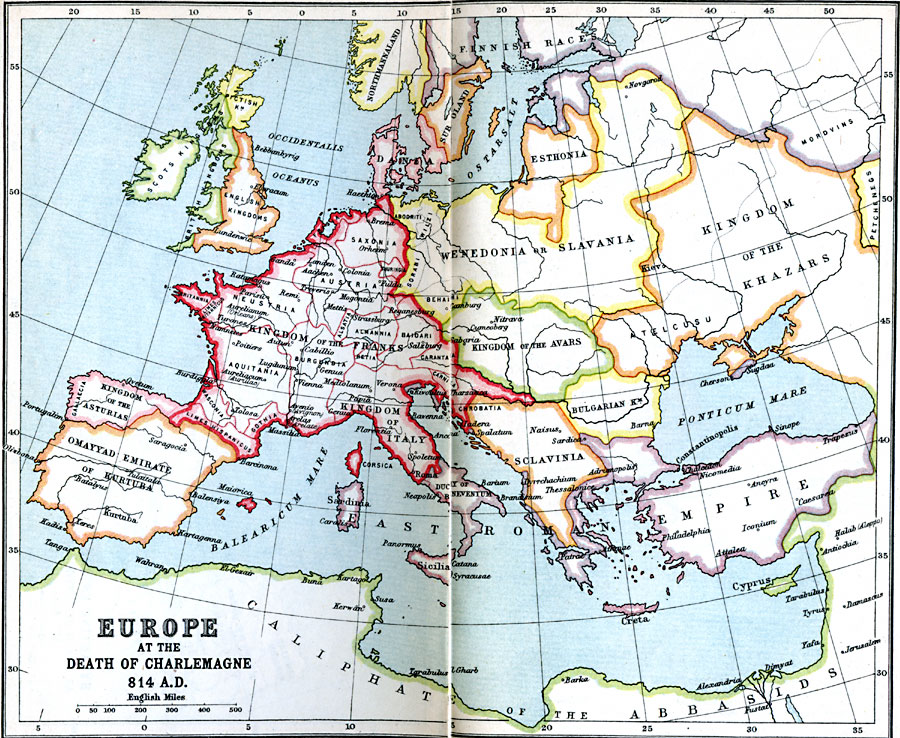
Description: A map of Europe at the time of Charlemagne's death in AD 814 showing the extent of the Kingdom of the Franks, which included the Kingdom of Italy, Frisia, Saxonia, Britannia, Limes Britannicus, Neustria, Thuringia, Aquitania, Wasconia, Limes Hispanicus, Gothia, Bergundia, Alsatia, Almannia, Baioari, Retia, Carantania, Carniola, Chrobatia, and Austria (also known at the time as Austrasia which was situated in portions of today's northeastern France, western Germany, Belgium, Luxemburg, and the Netherlands). Important cities shown in the Kingdom of the Franks include Brema (Bremen), Colonia (Cologne), Fulda, Aachen, Reganesburg (Regansburg), Parisü (Paris), Aurelianum (Orleans), Tolosa (Toulouse), Avenio, (Avignon), Massilia (Marseille), Genua (Geneva in Switzerland and Genoa in Italy), Mediolanum (Milan), and Roma (Rome). Other territories in Europe shown on the map include the Scots, British, Pictish, and English kingdoms of the British Isles, Kingdom of the Asturias and Omayyad Emirate of Kurtuba on the Iberian Peninsula, portions of Northmannaland (Norway) and the territories of the Finnish Races, Sub Oland (Sweden), Dania, Esthonia, Kingdom of the Khazars, Wenedonia or Slavania, Kingdom of the Avars, Duchy of Beneventum, Sclavinia, Bulgarian Kingdom, the East Roman or Byzantine Empire, and the Caliphate of the Abbasids in North Africa and the Middle East.
Place Names: Western and Central Europe, France, �Germany, �Greece, �Italy, �Romania, �Spain, �United Kingdo
ISO Topic Categories: inlandWaters,
location,
oceans
Keywords: Europe at the Death of Charlemagne, country borders, �political, kCharlemagne, country borders, inlandWaters,
location,
oceans, Unknown, A.D. 814
Source: J.G. Bartholomew, LLD, A Literary & Historical Atlas of Europe (New York, NY: E.P. Dutton & Co., Ltd. , 1910) 14-15
Map Credit: Courtesy the private collection of Roy Winkelman |
|