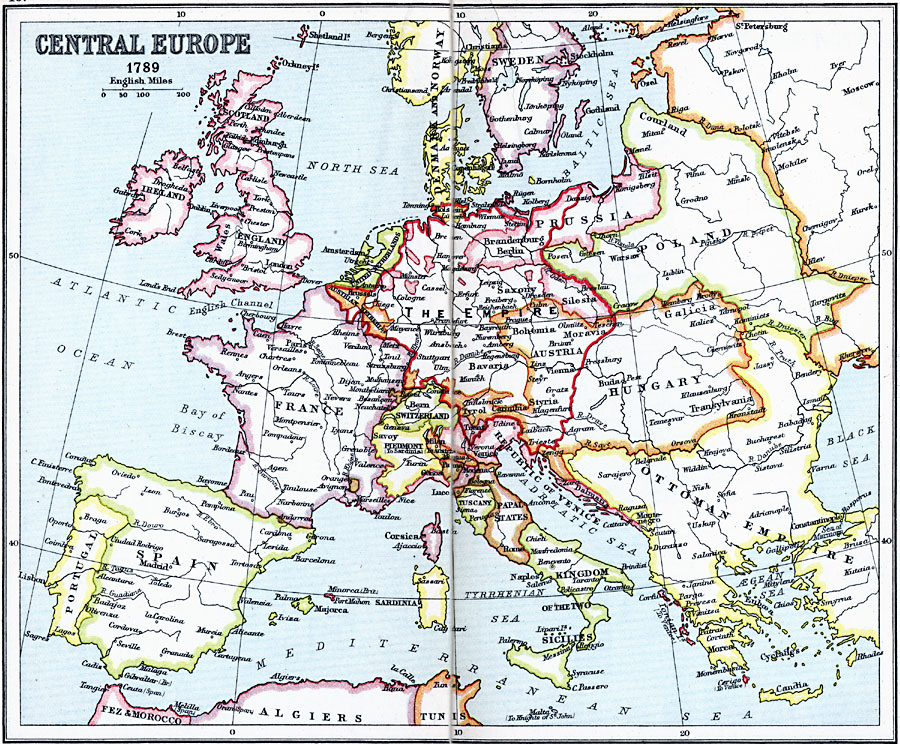
Description: A map of Central Europe in 1789 showing the Holy Roman Empire under the House of Habsburg–Lorraine, Denmark and Norway under the House of Oldenburg, the existence of Poland prior to the three partitions, the extent of the Ottoman Turks into Europe, and the Italian peninsular countries of the Republic of Venice, Parma, Modena, Lucca, Tuscany, Papal States, and the Kingdom of the two Sicilies.
Place Names: Western and Central Europe, Denmark, �France, �Hungary, �Italy, �Norway, �Ottoman Empire, �Poland, �Portugal, �Russia, �Spain, �Swede
ISO Topic Categories: inlandWaters,
location,
oceans
Keywords: Central and Western Europe, country borders, �political, country borders, inlandWaters,
location,
oceans, Unknown, 1789
Source: J.G. Bartholomew, LLD, A Literary & Historical Atlas of Europe (New York, NY: E.P. Dutton & Co., Ltd. , 1910) 40-41
Map Credit: Courtesy the private collection of Roy Winkelman |
|