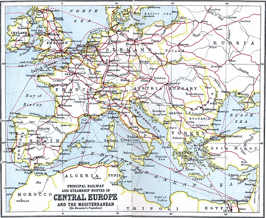
Description: Map shows principal railways and steamship routes throughout Central Europe and the Mediterranean Sea in 1910. This map also shows major cities and rivers, and uses the Mercator's Projection.
Place Names: A Complete Map of Europe, Austria, �Bulgaria, �England, �France, �Germany, �Greece, �Hungary, �Italy, �Poland, �Portugal, �Romania, �Spain, �Sweden, �Switzerland, �Turkey, �United Kingdo
ISO Topic Categories: inlandWaters,
location,
oceans,
transportation
Keywords: Principal Railway and Steamship Routes in Central Europe and the Mediterranean, country borders, �political, �transportation, �railroads, �water routes, kMapProjection, kTransportation, country borders, railroads,
water routes, inlandWaters,
location,
oceans,
transportation, Mercator,
Unknown, 1910
Source: J.G. Bartholomew, LLD, A Literary & Historical Atlas of Europe (New York, New York: E.P. Dutton & Co., Ltd. , 1910) 50-51
Map Credit: Courtesy the private collection of Roy Winkelman |
|