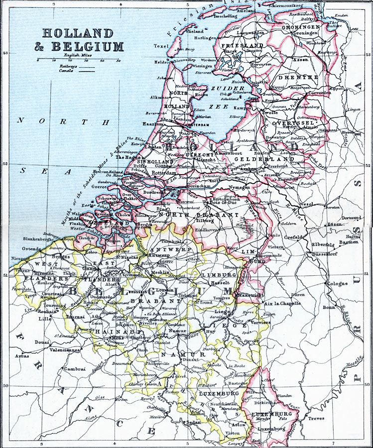
Description: A map from 1910 of Holland, Belgium, and Luxemburg, showing principal cities, railroads, canals, and provinces of the countries.
Place Names: Low Countries, Amsterdam, �Antwerp, �Belgium, �Flanders, �Holland, �Luxemburg, �Rotterdam, �Utrech
ISO Topic Categories: inlandWaters,
location,
oceans
Keywords: Holland, Belgium, and Luxemburg, physical, �physical features, �topographical, �political, �country borders, �transportation, �railways, topographical,
physical features, country borders, railroads, inlandWaters,
location,
oceans, Unknown, 1910
Source: J.G. Bartholomew, LLD, A Literary & Historical Atlas of Europe (New York, NY: E.P. Dutton & Co., Ltd. , 1910) 70-71
Map Credit: Courtesy the private collection of Roy Winkelman |
|