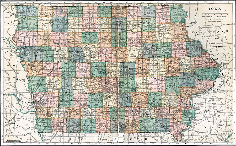
Description: A map from 1920 of Iowa showing the State capital of Des Moines, counties and county seats, major cities and towns, railroads, and rivers, including the border rivers of the Mississippi and Missouri.
Place Names: Iowa, Mason City, �Charles City, �Sioux City, �Correction Line, �Fort Dodge, �Waterloo, �Dubuque, �Boone, �Marshalltown, �Cedar Rapids, �Clinton, �Davenport, �Des Moines, �Omaha, �Council Bluffs, �Ottumwa, �Burlingto
ISO Topic Categories: boundaries,
inlandWaters,
location,
transportation
Keywords: Iowa, physical, �political, �transportation, physical features, major political subdivisions,
county borders, roads,
railroads, boundaries,
inlandWaters,
location,
transportation, Unknown, 1920
Source: , Leslie's New World Atlas (New York City, NY: Leslie-Judge Company, 1920) 70-71
Map Credit: Courtesy the private collection of Roy Winkelman |
|