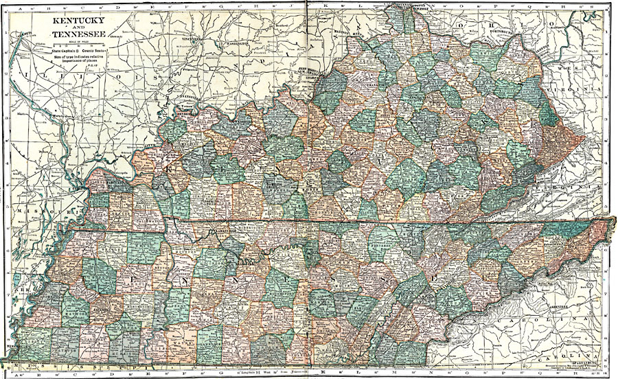
Description: A map from 1920 of Kentucky and Tennessee showing county boundaries, State capitals, county seats, major cities and towns, railroads, rivers, and terrain features of the area.
Place Names: Eastern States, Cairo, �Memphis, �Paducah, �Jackson, �Henderson, �Mount Vernon, �Hopkinsville, �Clarksville, �Nashville, �Bowling Green, �Owensboro, �Nashville, �Chattanooga, �Louisville, �Jeffersonville, �New Albany, �Frankfort, �Knoxville, �Richmond, �Lexington, �Wi
ISO Topic Categories: boundaries,
inlandWaters,
location,
transportation
Keywords: Kentucky and Tennessee, physical, �political, �transportation, physical features, major political subdivisions,
county borders, roads,
railroads, boundaries,
inlandWaters,
location,
transportation, Unknown, 1920
Source: , Leslie's New World Atlas (New York City, NY: Leslie-Judge Company, 1920) 58-59
Map Credit: Courtesy the private collection of Roy Winkelman |
|