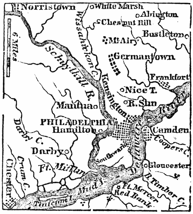
Description: A map from 1872 of the vicinity of Philadelphia. "Philadelphia City, now the second in size and population in the United States, is situated between the Delaware and Schuylkill Rivers, five miles above their junction, and 120 miles, by the Delaware River, from the ocean. It is about eighty miles, in a direct line, S.W. from New York, and 125 N.E. from Washington. The compact part of the city is now more than eight miles in circumference." Wilson, 1872, p. 152.
Place Names: Pennsylvania, Philadelphia, �Hamilton, �Germanytown, �Camde
ISO Topic Categories: inlandWaters,
location
Keywords: Philadelphia and Vicinity, political, �physical, physical features, local jurisdictions, inlandWaters,
location, Unknown, 1872
Source: Marcius Willson, History of the United States (New York, NY: Ivison, Blakeman, Taylor, and Co., 1872) 152
Map Credit: Courtesy the private collection of Roy Winkelman |
|