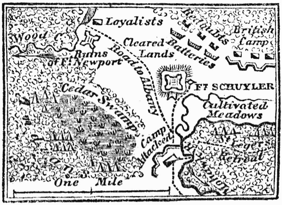
Description: A map of the vicinity of Fort Schuyler, also known at the time as Fort Stanwix, during the campaign of British General Burgoyne to control the Hudson Valley (1777) in the American Revolutionary War. The map shows the British and Iroquois positions during the siege of the American fort, and the route of St' Leger's retreat.
Place Names: New York, Fort Schuyle
ISO Topic Categories: intelligenceMilitary,
location,
biota
Keywords: Fort Schuyler or Fort Stanwix, physical, �statistical, �historical, kAmericanRevolution, physical features, vegetation, American Revolution, intelligenceMilitary,
location,
biota, Unknown, 1777
Source: Marcius Willson, History of the United States (New York, NY: Ivison, Blakeman, Taylor, and Co., 1872) 242
Map Credit: Courtesy the private collection of Roy Winkelman |
|