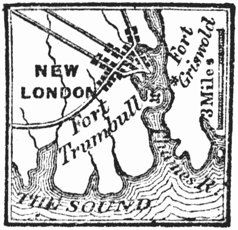
Description: A map of New London on the Thames River, Connecticut, showing the important Fort Griswold and Fort Trumbull during the American Revolutionary War, site of the Battle of Groton Heights in 1781.
Place Names: Connecticut, New London, �Fort Trumbul
ISO Topic Categories: intelligenceMilitary,
inlandWaters,
location,
oceans,
transportation
Keywords: New London, physical, �political, �historical, �transportation, physical features, local jurisdictions, roads, American Revolution, intelligenceMilitary,
inlandWaters,
location,
oceans,
transportation, Unknown, 1781
Source: Marcius Willson, History of the United States (New York, NY: Ivison, Blakeman, Taylor, and Co., 1872) 277
Map Credit: Courtesy the private collection of Roy Winkelman |
|