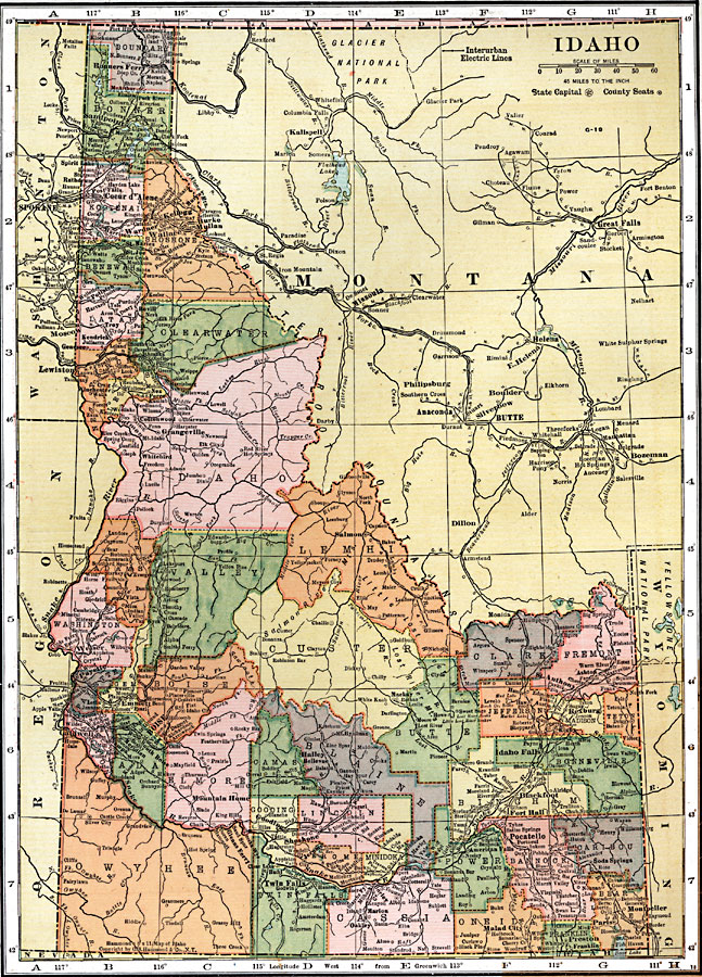
Description: A map from 1920 of Idaho showing the capital city Boise, counties and county seats, towns, railroads, interurban electric lines, mountain systems, lakes, and rivers.
Place Names: Idaho, Bonners Ferry, �Sandpoint, �Spirit Lake, �Rathdrum, �Post Falls, �Coeur d'Alene, �Kellogg, �Murray, �Burke Mullan, �Wardner, �Harrison, �Wallace, �St. Maries, �St. Joe, �Potlatch, �Bovill, �Troy, �Kendrick, �Moscow, �Genesee, �Lewiston, �Winchester, �C
ISO Topic Categories: boundaries,
inlandWaters,
location,
transportation
Keywords: Idaho, physical, �political, �transportation, physical features, country borders,
major political subdivisions,
county borders, roads,
railroads, boundaries,
inlandWaters,
location,
transportation, Unknown, 1920
Source: , Leslie's New World Atlas (New York City, NY: Leslie-Judge Company, 1920) 92
Map Credit: Courtesy the private collection of Roy Winkelman |
|