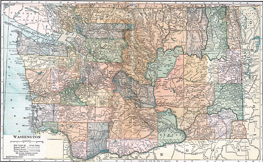
Description: A map from 1920 of Washington showing the capital, Olympia, counties and county seats, principal cities and towns, Indian reservations, National Park and Forest boundaries, railroads, mountains, lakes, rivers, and coastal features of the Puget Sound and Pacific.
Place Names: Washington, Blaine, �Bellingham, �Victoria, �Anacortes, �Mount Vernon, �Colville, �Evertt, �Port Townsend, �Seattle, �Davenport, �Spokane, �Hoquiam, �Aberdeen, �Montesano, �Olympia, �Tacoma, �Buckley, �Roslyn, �Ellensburg, �Colfax, �North Yakima, �Astoria, �Vancou
ISO Topic Categories: boundaries,
inlandWaters,
location,
oceans,
transportation
Keywords: Washington, physical, �political, �transportation, kNativeAmerican, physical features, major political subdivisions,
county borders,
country borders, railroads,
roads, boundaries,
inlandWaters,
location,
oceans,
transportation, Unknown, 1920
Source: , Leslie's New World Atlas (New York City, NY: Leslie-Judge Company, 1920) 102-103
Map Credit: Courtesy the private collection of Roy Winkelman |
|