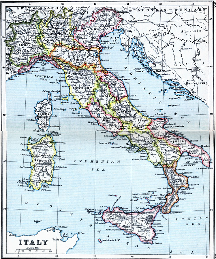
Description: A map of Italy in 1910, color–coded to show the larger compartimenti (provinces) prior to the resolution of the Italian Irredentist Movement. This map shows the territories of Tyrol, Istria, and Dalmatia under Austria–Hungary Empire rule, and the island of Corsica not under Italian control. The map shows major cities, towns, ports, railways, rivers, and terrain.
Place Names: Italy, Rome, �Abruzzi, �Apulia, �Bologna, �Calabria, �Florence, �Genoa, �Messina, �Milan, �Naples, �Pisa, �Sardinia, �Sicily, �Tuscany, �Umbria, �Venice, �Veron
ISO Topic Categories: inlandWaters,
location,
oceans
Keywords: Italy, physical, �physical features, �topographical, �political, �country borders, topographical,
physical features, country borders, inlandWaters,
location,
oceans, Unknown, 1910
Source: J.G. Bartholomew, LLD, A Literary & Historical Atlas of Europe (New York, New York: E.P. Dutton & Co., Ltd. , 1910) 80-81
Map Credit: Courtesy the private collection of Roy Winkelman |
|