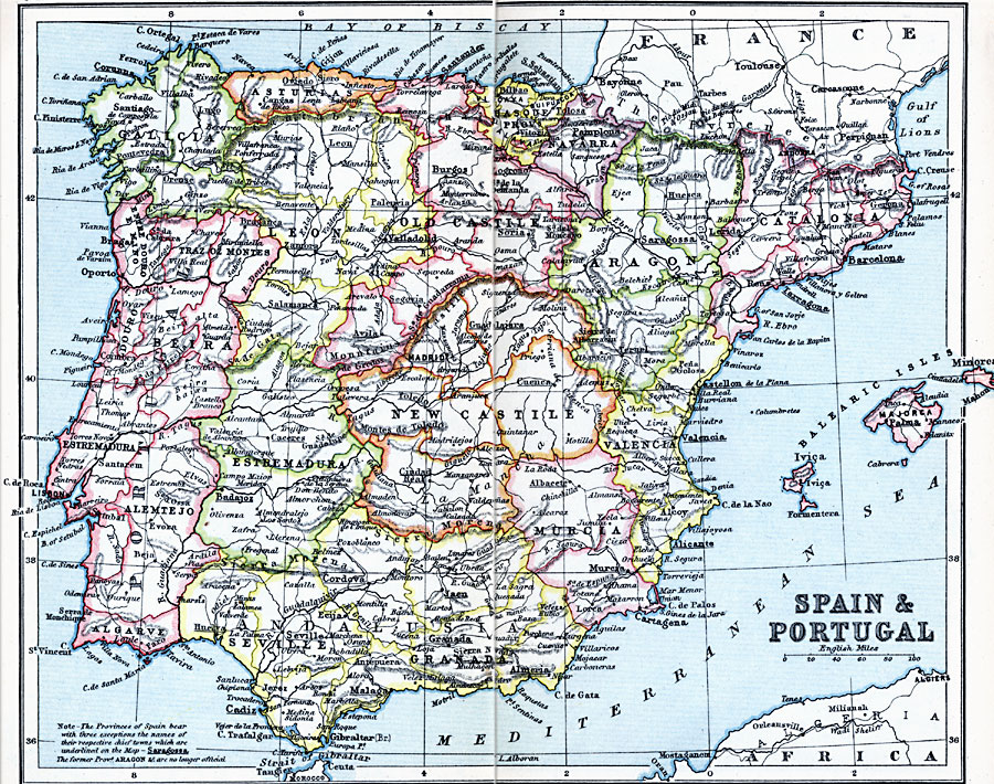
Description: A map of Spain and Portugal in 1910 showing country borders, provinces, major cities and towns, railways, rivers, and mountain systems. The map notes "The Provinces of Spain bear with three exceptions the names of their respective chief towns which are underlined on the map... The former Province Aragon et cetera are no longer official."
Place Names: Iberian Peninsula, Andalusia, �Aragon, �Asturias, �Beira, �Cadiz, �Catalonia, �Estremadura, �Granada, �Leon, �Madrid, �New Castile, �Old Castile, �Pamplona, �Portugal, �Spain, �Valenci
ISO Topic Categories: inlandWaters,
location,
oceans
Keywords: Spain and Portugal, physical, �physical features, �topographical, �political, �country borders, topographical,
physical features, country borders, inlandWaters,
location,
oceans, Unknown, 1910
Source: J.G. Bartholomew, LLD, A Literary & Historical Atlas of Europe (New York, NY: E.P. Dutton & Co., Ltd. , 1910) 84-85
Map Credit: Courtesy the private collection of Roy Winkelman |
|