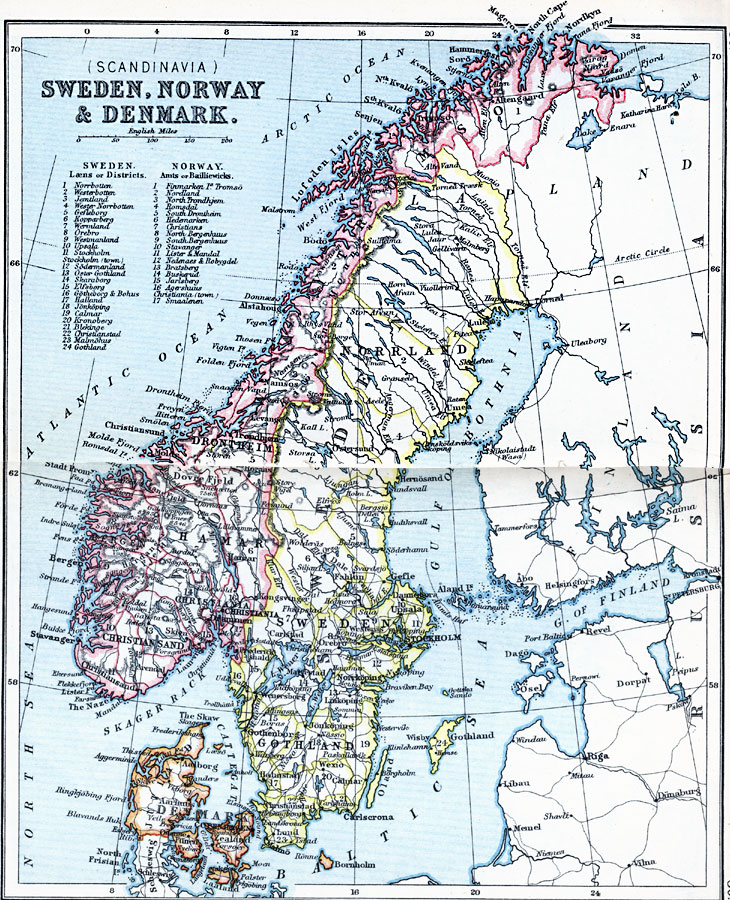
Description: Map shows the Scandinavian countries of Sweden, Norway, and Denmark in 1910, with a reference key to the lands and districts of Norway and Sweden. The map shows major cities and towns, railways, rivers, lakes, terrain, and coastline.
Place Names: Sweden, Denmark, �Gothland, �Hamar, �Norway, �Scandinavia, �Stockholm, �Sweden, �Tromso,
ISO Topic Categories: inlandWaters,
location,
oceans
Keywords: Sweden, Norway & Denmark, physical, �physical features, �topographical, �political, �country borders, topographical,
physical features, country borders, inlandWaters,
location,
oceans, Unknown, 1910
Source: J.G. Bartholomew, LLD, A Literary & Historical Atlas of Europe (New York, New York: E.P. Dutton & Co., Ltd. , 1910) 88-89
Map Credit: Courtesy the private collection of Roy Winkelman |
|