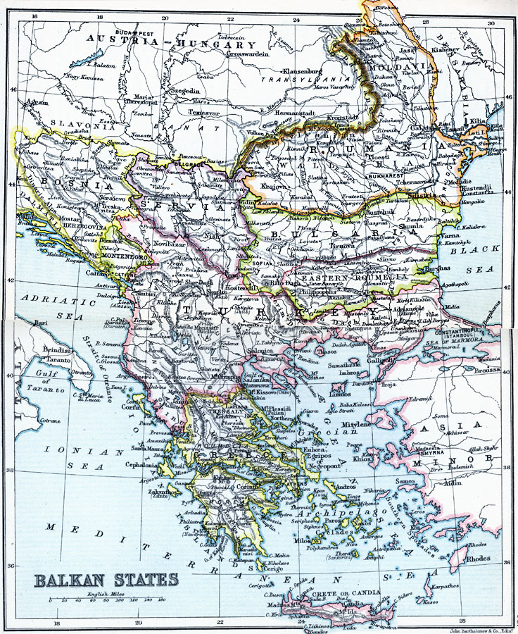
Description: A map from 1910 of the Balkan States, including Turkey, showing borders and capitals, principal cities and towns, railroads, mountain systems, lakes, rivers, and coastal features.
Place Names: Southeastern Europe, Balkan States, �Bosnia, �Bulgaria, �Greece, �Moldavia, �Roumania, �Servia, �Turkey,
ISO Topic Categories: inlandWaters,
location,
oceans
Keywords: Balkan States, physical, �physical features, �topographical, �political, �country borders, topographical,
physical features, country borders, inlandWaters,
location,
oceans, Unknown, 1910
Source: J.G. Bartholomew, LLD, A Literary & Historical Atlas of Europe (New York, NY: E.P. Dutton & Co., Ltd. , 1910) 94-95
Map Credit: Courtesy the private collection of Roy Winkelman |
|