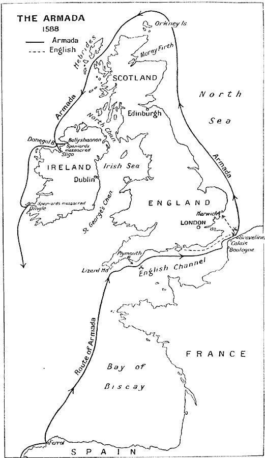
Description: A map showing the route of the Spanish Armada in 1588 from Ferrol across Biscay Bay, through the English Channel to Flanders and the Battle of Gravelines, then through the North Sea around the British Isles to Ireland's Donegal Bay where the Spaniards were massacred at Ballyshannon and Sligo, and further south to Dingle, site of another Spanish massacre.
Place Names: British Isles, England, �France, �Ireland, �Scotland, �Spai
ISO Topic Categories: inlandWaters,
location,
oceans
Keywords: The Armada, battle, �historical, �military, �historical event,
other military, inlandWaters,
location,
oceans, Unknown, 1588
Source: J.G. Bartholomew, LLD, A Literary & Historical Atlas of Europe (New York, NY: E.P. Dutton & Co., Ltd. , 1910) 118
Map Credit: Courtesy the private collection of Roy Winkelman |
|