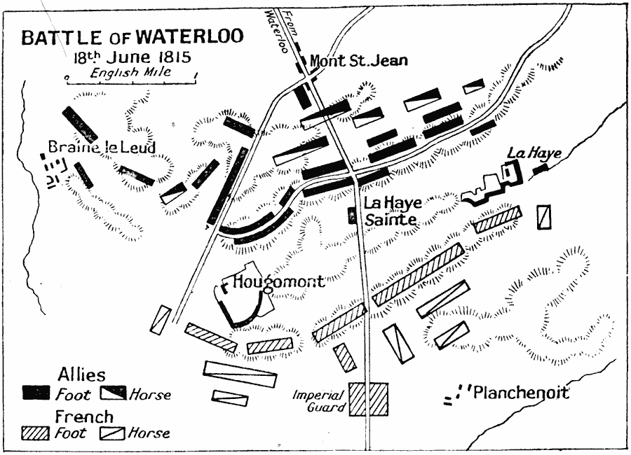
Description: A map of the Battle of Waterloo in present day Belgium. The battle was between the army of the French Empire under Napoleon Bonaparte, and the armies of the Seventh Coalition made up of the Prussian Army under the command of Gebhard von Bluecher and an Anglo–Allied army under the command of Wellington. This battle of the three day Waterloo Campaign was fought on 18th June, 1815, resulting in a defeat for the French, and the end of Napoleon's rule as Emperor of the French.
Place Names: Belgium, France, �Hougomont, �La Haye Sainte, �Waterlo
ISO Topic Categories: inlandWaters,
location,
oceans
Keywords: Battle of Waterloo, battle, �historical, �military, kBattle, kNapoleonBonaparte, historical event,
other military, inlandWaters,
location,
oceans, Unknown, June 18, 1815
Source: J.G. Bartholomew, LLD, A Literary & Historical Atlas of Europe (New York, New York : E.P. Dutton & Co., Ltd. , 1910) 121
Map Credit: Courtesy the private collection of Roy Winkelman |
|