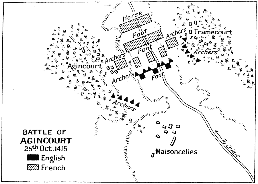
Description: A map of the Battle of Agincourt in northern France during the Hundred Years' War. The battle was between the army of the Kingdom of England under Henry V, and the army of the Kingdom of France led by Constable Charles d'Albret. This battle was fought on 25th October, 1415, and resulted in a decisive victory for the English against a larger French force.
Place Names: France, Agincourt, �England, �France, �Maisoncelles, �Tramecourt, �United Kingdo
ISO Topic Categories: inlandWaters,
location,
oceans
Keywords: Battle of Agincourt, battle, �historical, �military, kBattle, kHundredYearsWar, historical event,
other military, inlandWaters,
location,
oceans, Unknown, October 25, 1415
Source: J.G. Bartholomew, LLD, A Literary & Historical Atlas of Europe (New York, New York: E.P. Dutton & Co., Ltd. , 1910) 124
Map Credit: Courtesy the private collection of Roy Winkelman |
|