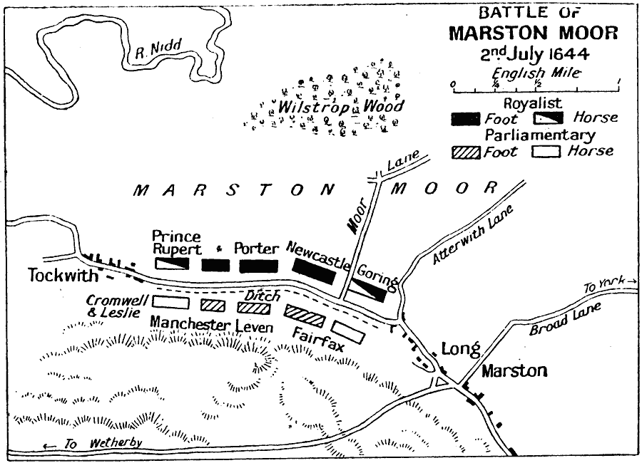
Description: A map of the Battle of Marston Moor, York, England during the First English Civil War. The battle pitted the combined forces of the Scottish Covenanters and Parliamentarians against the Royalists army. This battle, fought on 2nd July 1644, resulted in a defeat for the Royalists.
Place Names: United Kingdom, England, �Fairfax, �Goring, �Leven, �Long, �Marston, �Manchester, �Tockwith, �Wilstrop Woo
ISO Topic Categories: inlandWaters,
location,
oceans
Keywords: Battle of Marston Moor, battle, �historical, �military, kBattle, kEnglishCivilWar, historical event,
other military, inlandWaters,
location,
oceans, Unknown, July 2, 1644
Source: J.G. Bartholomew, LLD, A Literary & Historical Atlas of Europe (New York, New York: E.P. Dutton & Co., Ltd. , 1910) 125
Map Credit: Courtesy the private collection of Roy Winkelman |
|