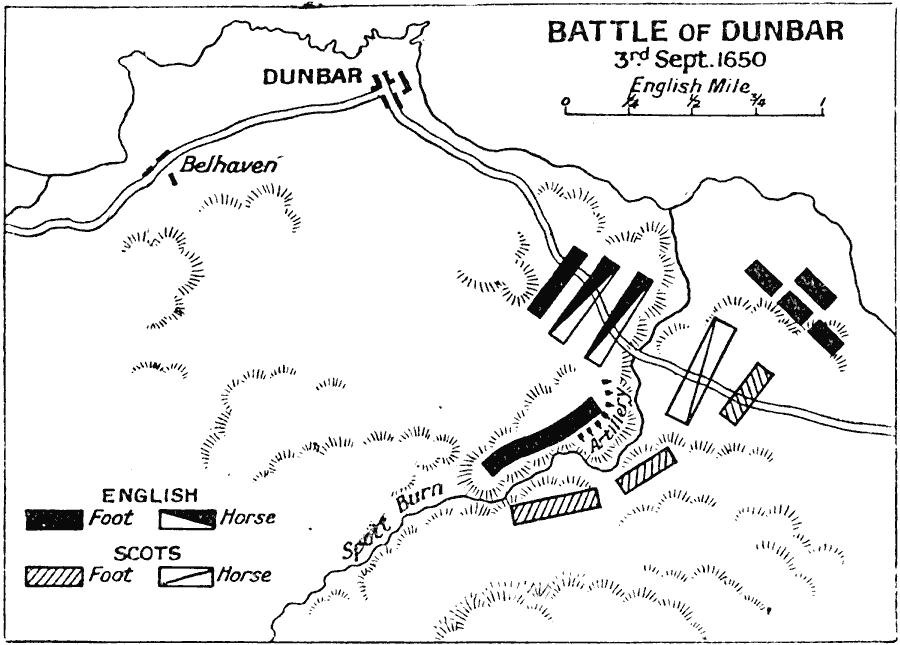
Description: Map shows the Battle of Dunbar, 3rd September 1650, during the Third English Civil War. The battle was fought between the English Parliamentarians under Oliver Cromwell and the Scottish Covenanters under David Leslie. The battle was a decisive English Parliamentarian victory.
Place Names: United Kingdom, Belhaven, �Dunbar, �England, �Scotland, �United Kingdo
ISO Topic Categories: inlandWaters,
location,
oceans
Keywords: Battle of Dunbar, battle, �historical, �military, kBattle, kEnglishCivilWar, historical event,
other military, inlandWaters,
location,
oceans, Unknown, September 3, 1650
Source: J.G. Bartholomew, LLD, A Literary & Historical Atlas of Europe (New York, New York: E.P. Dutton & Co., Ltd. , 1910) 126
Map Credit: Courtesy the private collection of Roy Winkelman |
|