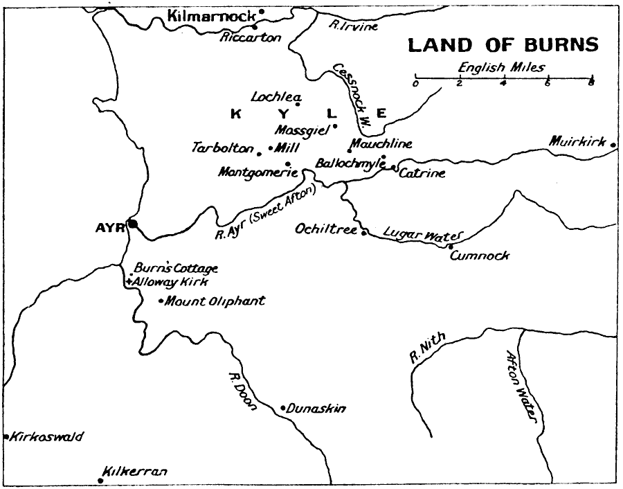
Description: A map showing the countryside of the Scottish poet Robert Burns (1759–1796). The map shows the town of Alloway Kirk (birthplace) and Burns' Cottage south of Ayr, Mount Oliphant, where he grew up, and Kilmarnock, where his first volume of poetry was published. This map also shows many of the rivers and towns mentioned in his literary works.
Place Names: United Kingdom, Ayr, �Kilmarnock, �Kyle, �Scotland,
ISO Topic Categories: inlandWaters,
location,
oceans
Keywords: Land of Burns, historical, kLiterature, inlandWaters,
location,
oceans, Unknown, 1759–1796
Source: J.G. Bartholomew, LLD, A Literary & Historical Atlas of Europe (New York, New York : E.P. Dutton & Co., Ltd. , 1910) 128
Map Credit: Courtesy the private collection of Roy Winkelman |
|