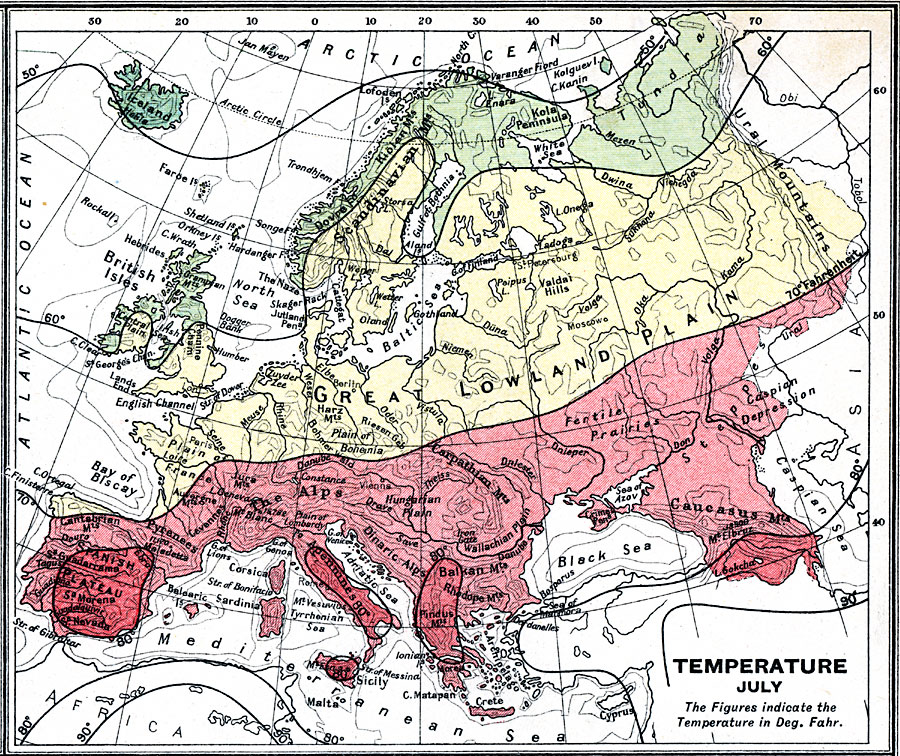
Description: A 1915 map showing averaged temperature isolines throughout Europe in July measured in degrees Fahrenheit and color–coded to show areal temperatures ranging from 50 to above 80 degrees. The map shows large bodies of water and landforms that effect temperatures in Europe, including the Atlantic, Mediterranean, North Sea, Black Sea, Great Lowland Plains, Dovre Kiölen Mountains, Gulf of Bothnia, Alps, Apennines, Spanish Plateau, and others.
Place Names: A Complete Map of Europe, Europe, �Spain, �United Kingdom, �Germany, �France, �Sweden, �Italy, �Romania, �Greece, �Poland, �Portuga
ISO Topic Categories: inlandWaters,
oceans,
location,
boundaries,
society,
climatologyMeteorologyAtmosphere
Keywords: Temperature in Europe - July, physical, �political, �borders, �meteorological, �temperature, kClimate, physical features, country borders, temperature, inlandWaters,
oceans,
location,
boundaries,
society,
climatologyMeteorologyAtmosphere, Unknown, 1915
Source: J.G. Bartholomew, A School Economic Atlas (London, England: Oxford University Press, 1915) 18
Map Credit: Courtesy the private collection of Roy Winkelman |
|