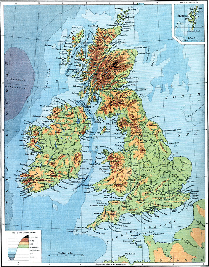
Description: A map from 1915 of the British Isles showing general land elevations and water depths of the region. The map uses color–contouring to show elevations from sea level to above 2500 feet and water depths at the 50, 100, and 1000 fathom lines. The map shows country boundaries and capitals, principal cities and towns, mountain systems, lakes, rivers, and coastal features. An inset map details the Shetland Islands.
Place Names: British Isles, Europe, �United Kingdo
ISO Topic Categories: inlandWaters,
oceans,
location,
boundaries
Keywords: British Isles - Bathy-Orographical, physical, �topographical, �political, �borders, �boundaries, �physical features,
topographical, country borders, inlandWaters,
oceans,
location,
boundaries, Unknown, 1915
Source: J.G. Bartholomew, A School Economic Atlas (London, England: Oxford University Press, 1915) 22
Map Credit: Courtesy the private collection of Roy Winkelman |
|